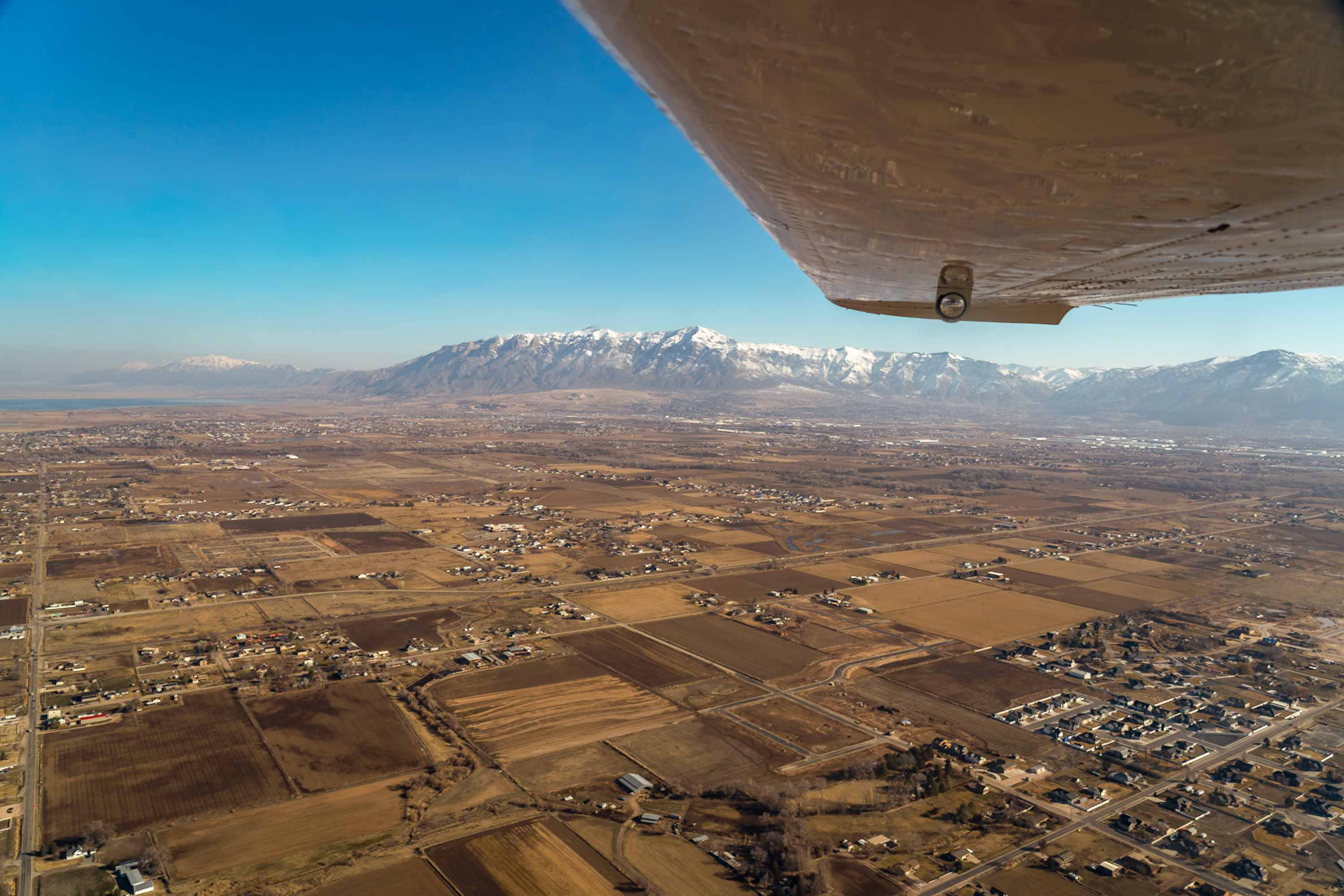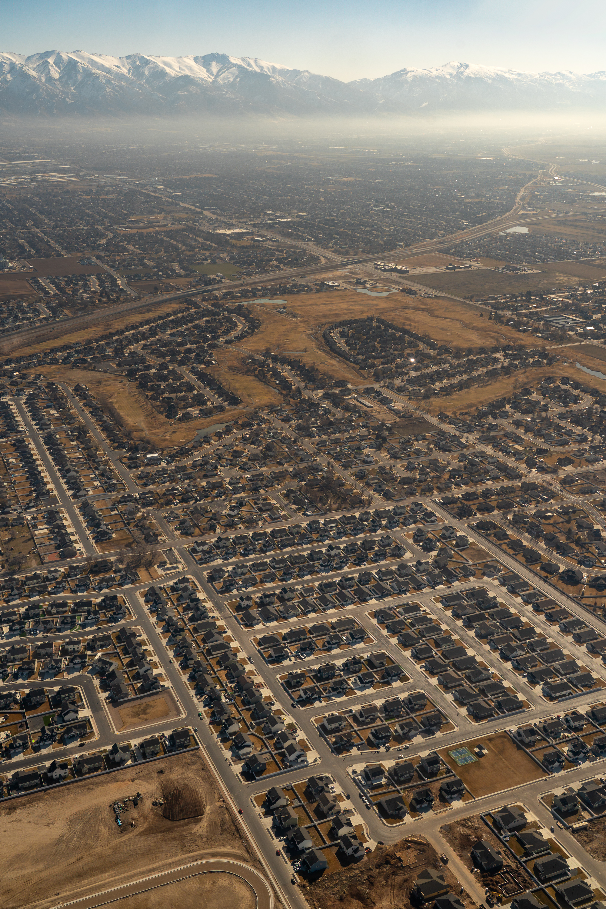
I hadn’t been in a single-engine, fixed-wing small aircraft in over 30 years, ever since cousin “Crazy” Jimmy took me for a spin up the Hudson River, “calmly” staring down at Manhattan from a thousand feet up whilst jet airliners, other small planes and numerous helicopters buzzed below and above us. But that’s a story for another time. Now I was winging over the rural lands of west Weber County (photo #1) on route to our first waypoint destination of the Spiral Jetty and Rozel Bay of the North Arm of the Great Salt Lake.
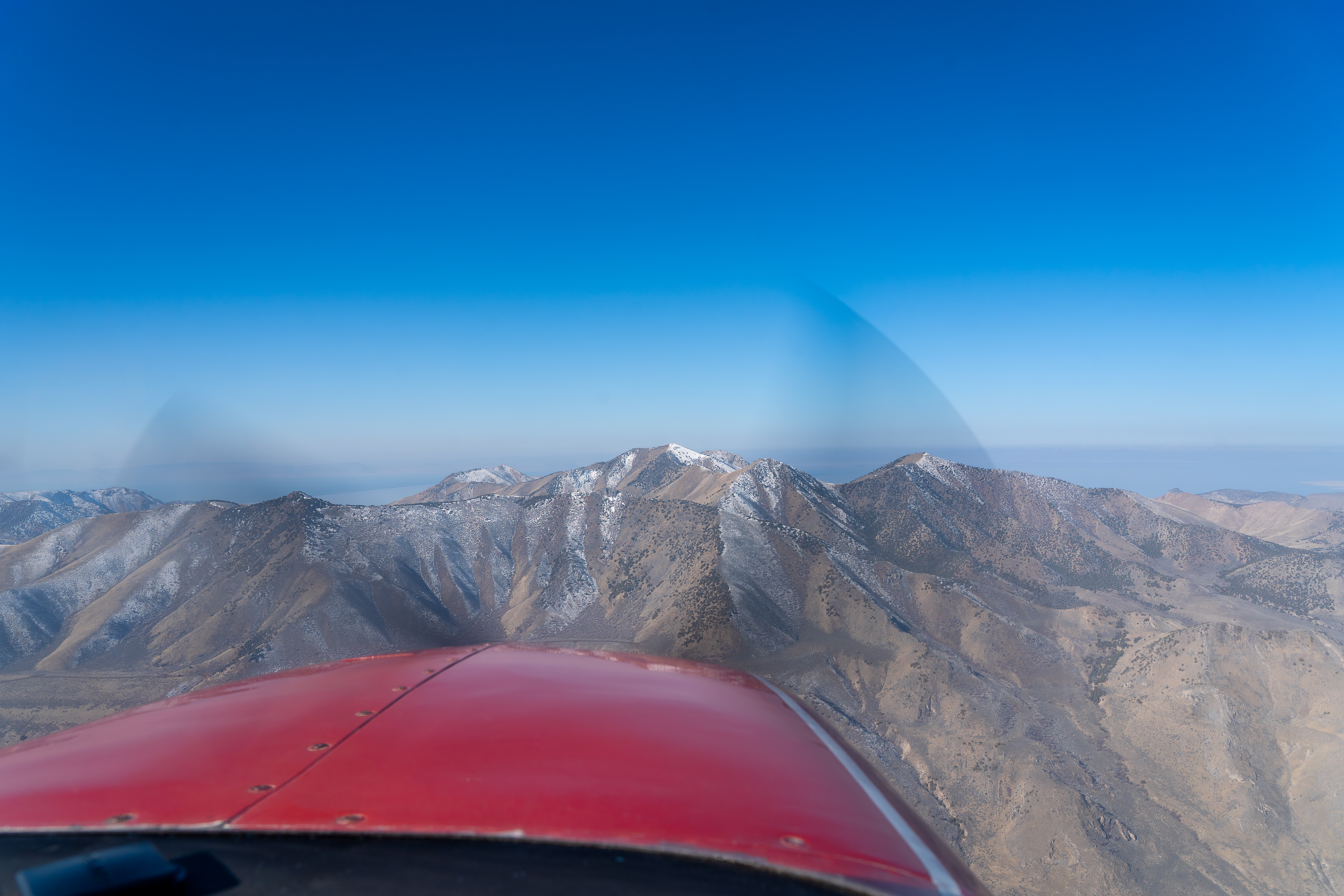
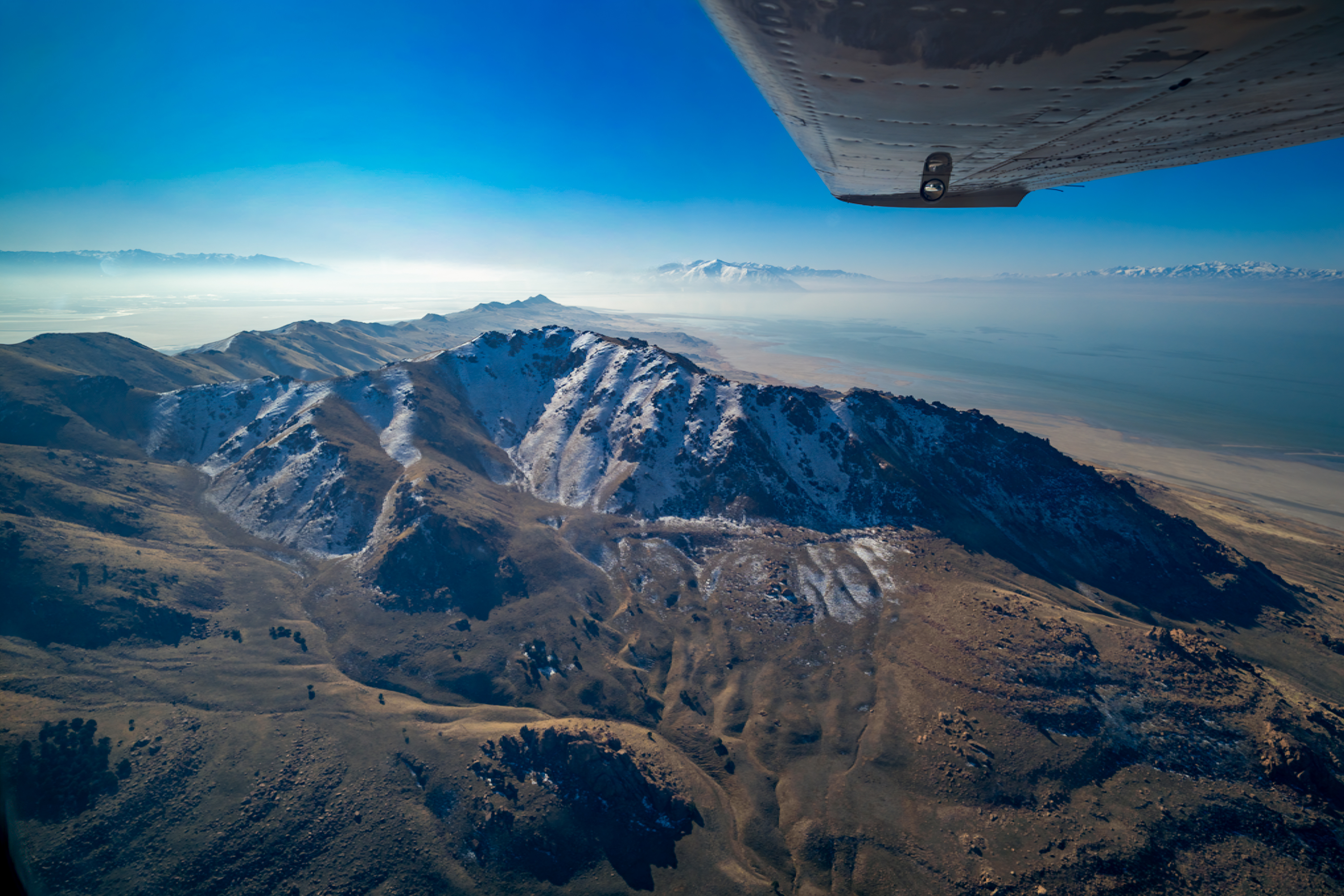
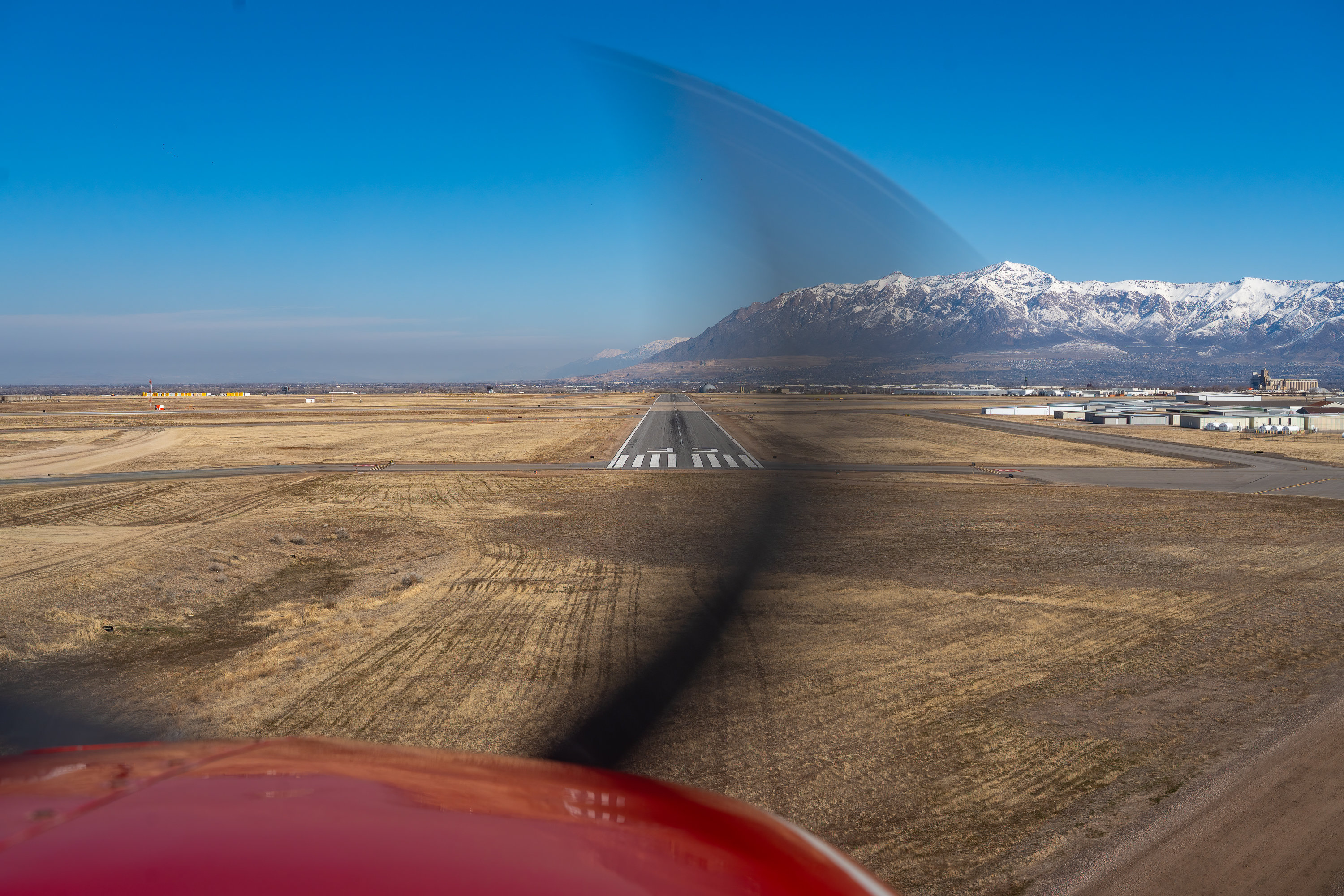
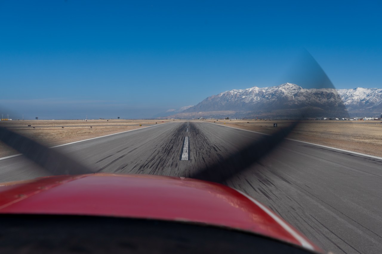
I had been contacted by Becky M., formerly of the Natural History Museum of Utah with whom I had worked with 10+ years ago on a photographic celebration exhibit commemorating the 50th anniversary of the Wilderness Act. She is now doing work for the Antelope Island State Park helping with scoping and designing their new visitor center. Becky wanted me to come with her on an over flight of the Great Salt Lake to try and photographically capture the interesting geology* (and geography) of the island. It was early March of this year (2025), when we finally took off from Ogden-Hinckley Airport. On board the 6-seater, single-engine craft were a couple of representatives from local environmental non-profits (Utah Chapter of the Sierra Club and Grow the Flow), Becky, a photographer-friend of hers, our steady pilot Bruce G.. (from the non-profit Ecoflight), and yours truly. The airplane was small, and the windows did not open but fortunately the craft was a wing over the fuselage model and even more fortuitous I was assigned the co-pilot seat and had good views forward and to the starboard (right). My only duty was to photograph as much and as often as I could. Shooting through plexiglass was challenging but the new Reflections Distractions Removal tool did a fairly good job of muting or removing the glass reflections and the amazing Generative AI removal did a great job of further cleaning up my images. Both of these tools are now available in Lightroom. Shooting straight ahead guaranteed a bit of prop in the shot (photo #2) so I did that rarely.
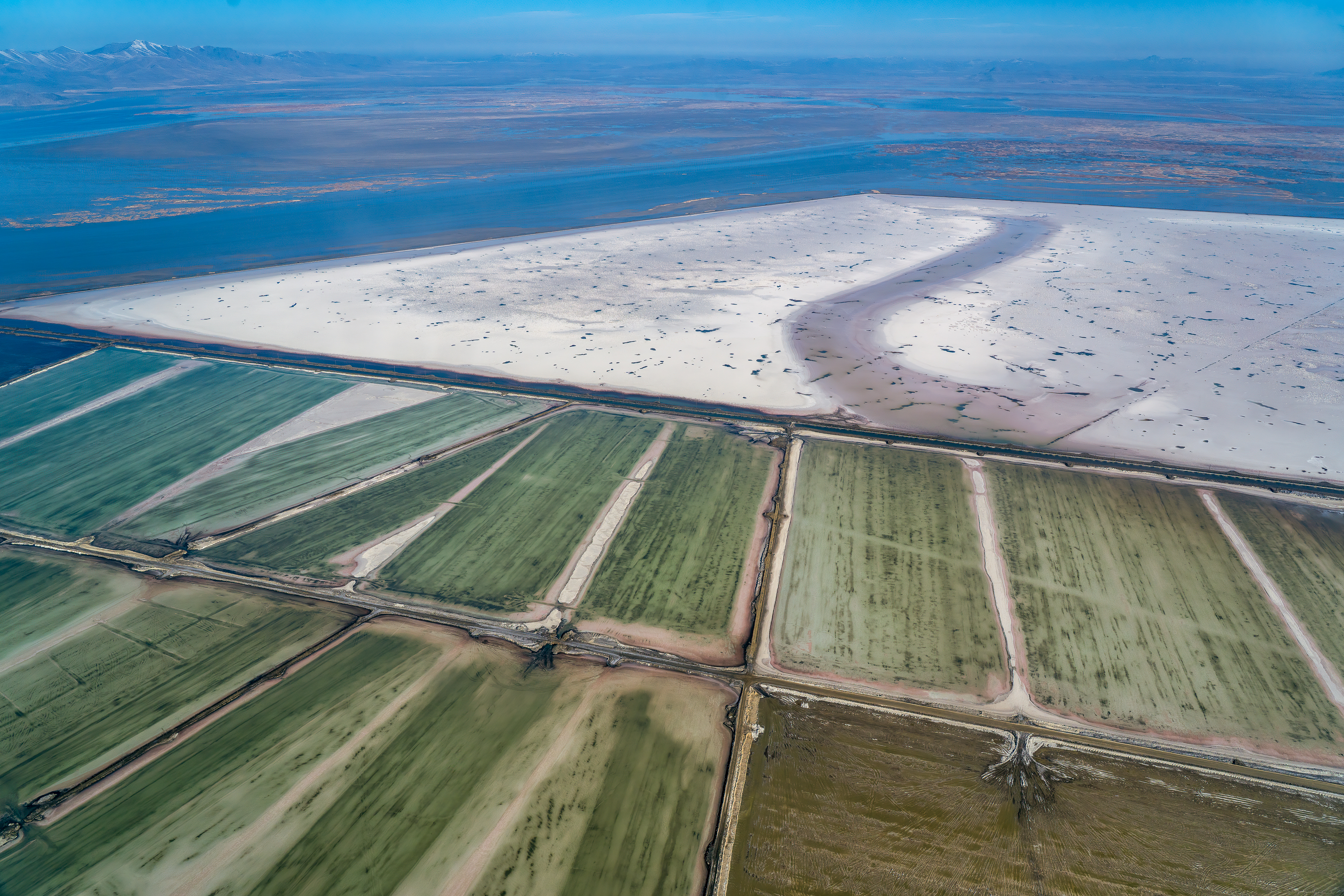
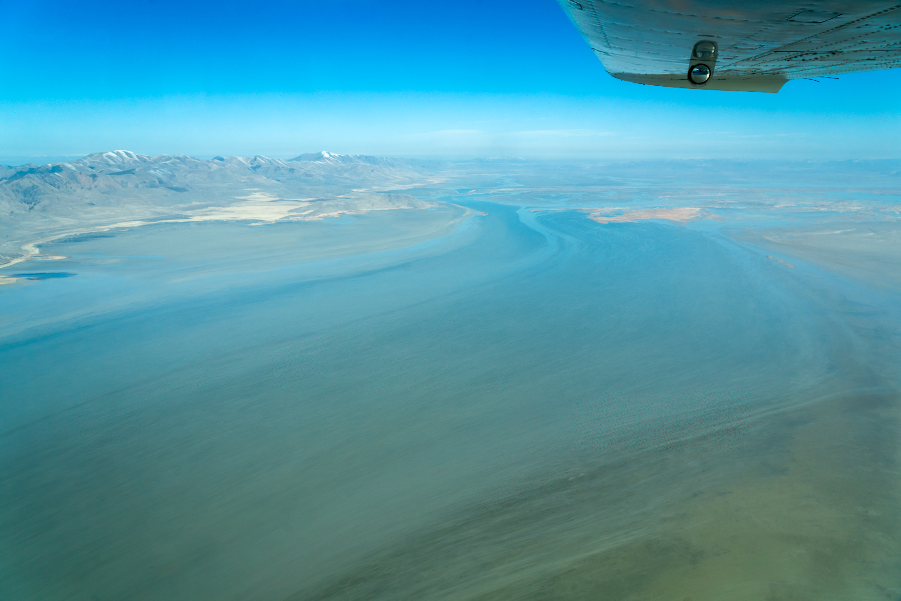
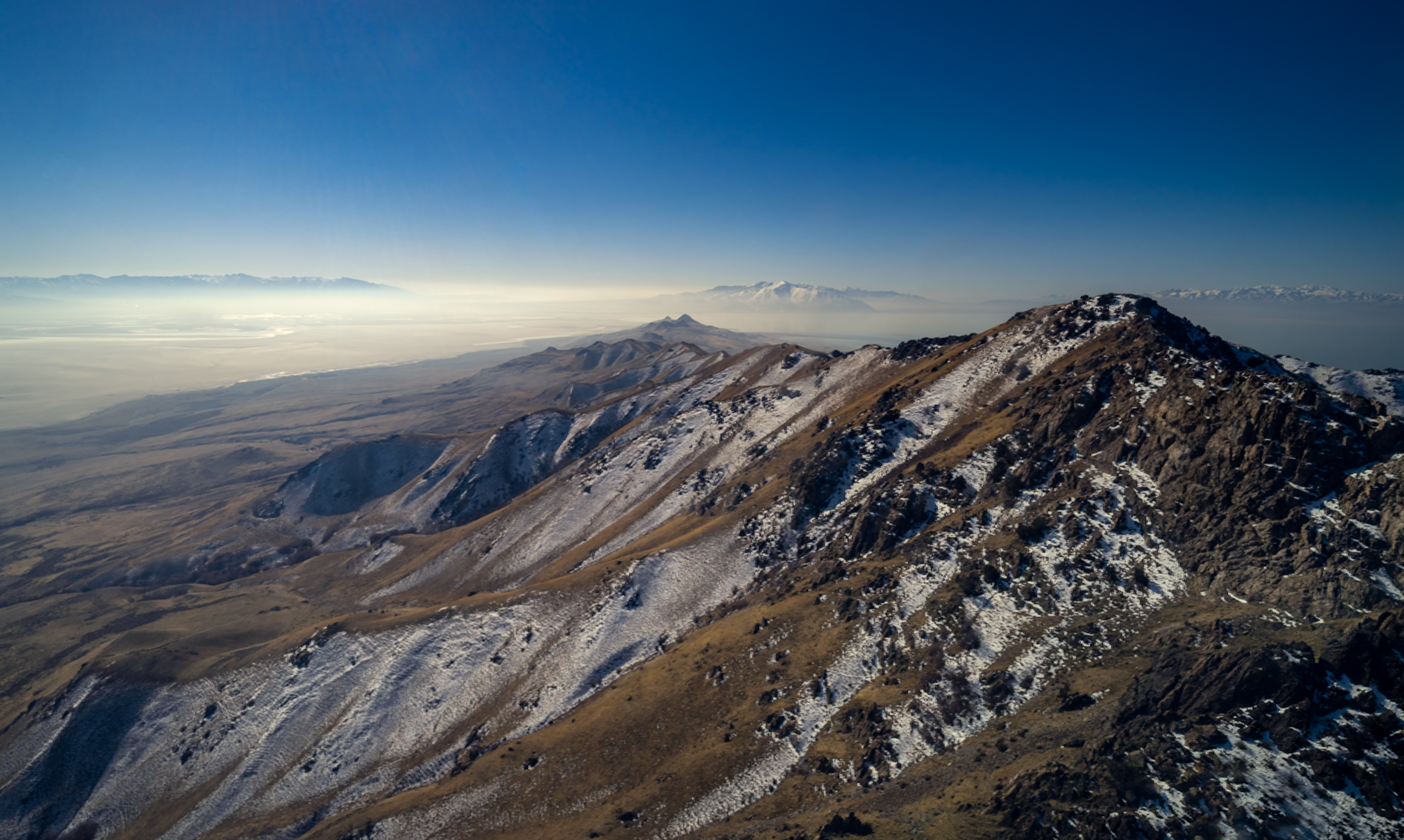
We climbed and headed straight for the Promontory Mountains (photo #3). But before getting to the crest of that range we passed over the Mondrian like evaporation ponds (photo #4) of Compass Minerals where they produce and process various salts (chlorides and sulfates) from the mineral-rich waters of the Great Salt Lake (GSL). Continuing west we passed over the waters of Bay River Bay (photo #5), the estuary where the Bear flows into the lake (one of the three river sources of water for the lake). This estuary is critical for the health of the lake as it provides habitat for millions of migratory birds. The Bear River Migratory Bird Refuge is a wonderful place not just for birds but for humans to birdwatch, photograph, and hike.
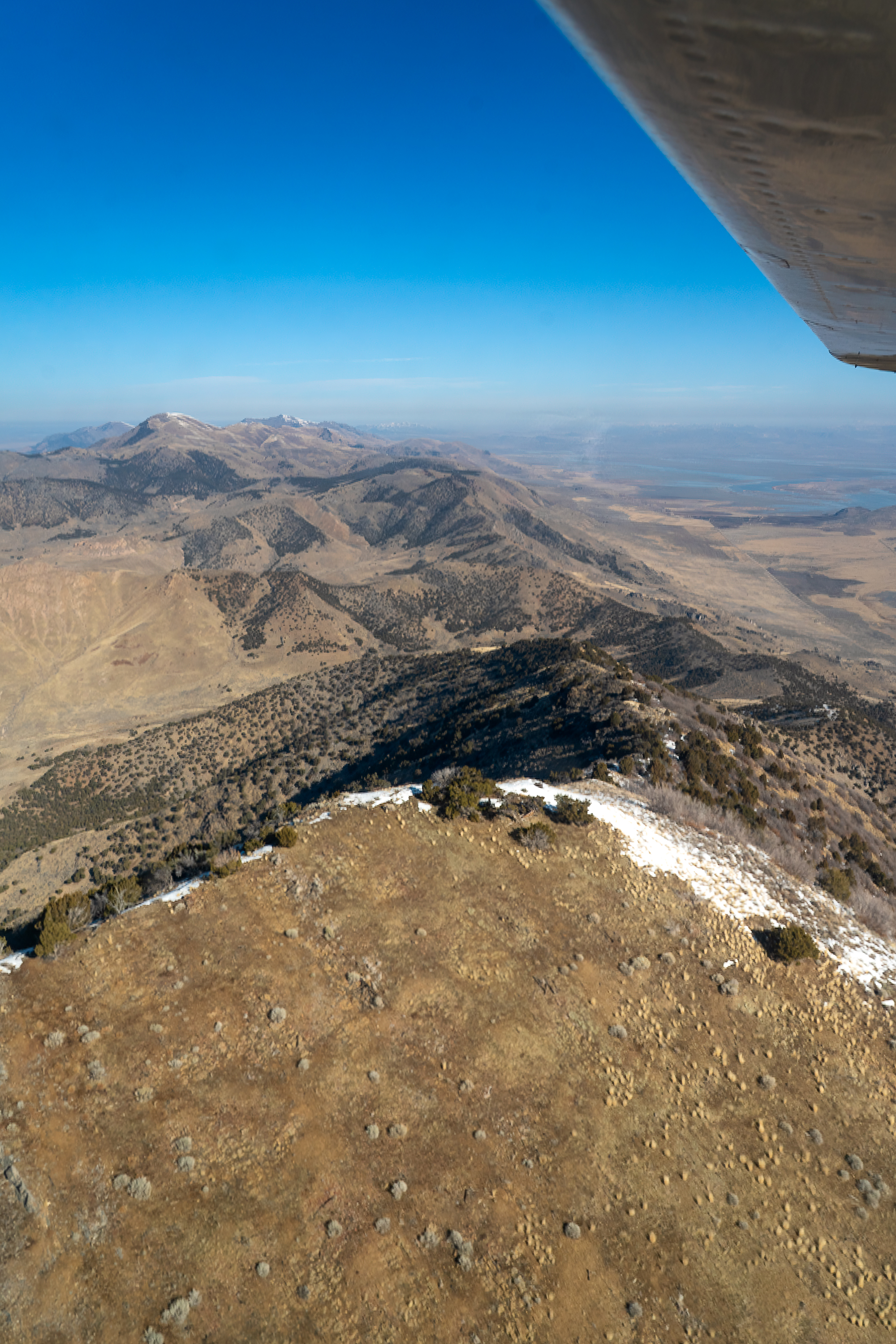
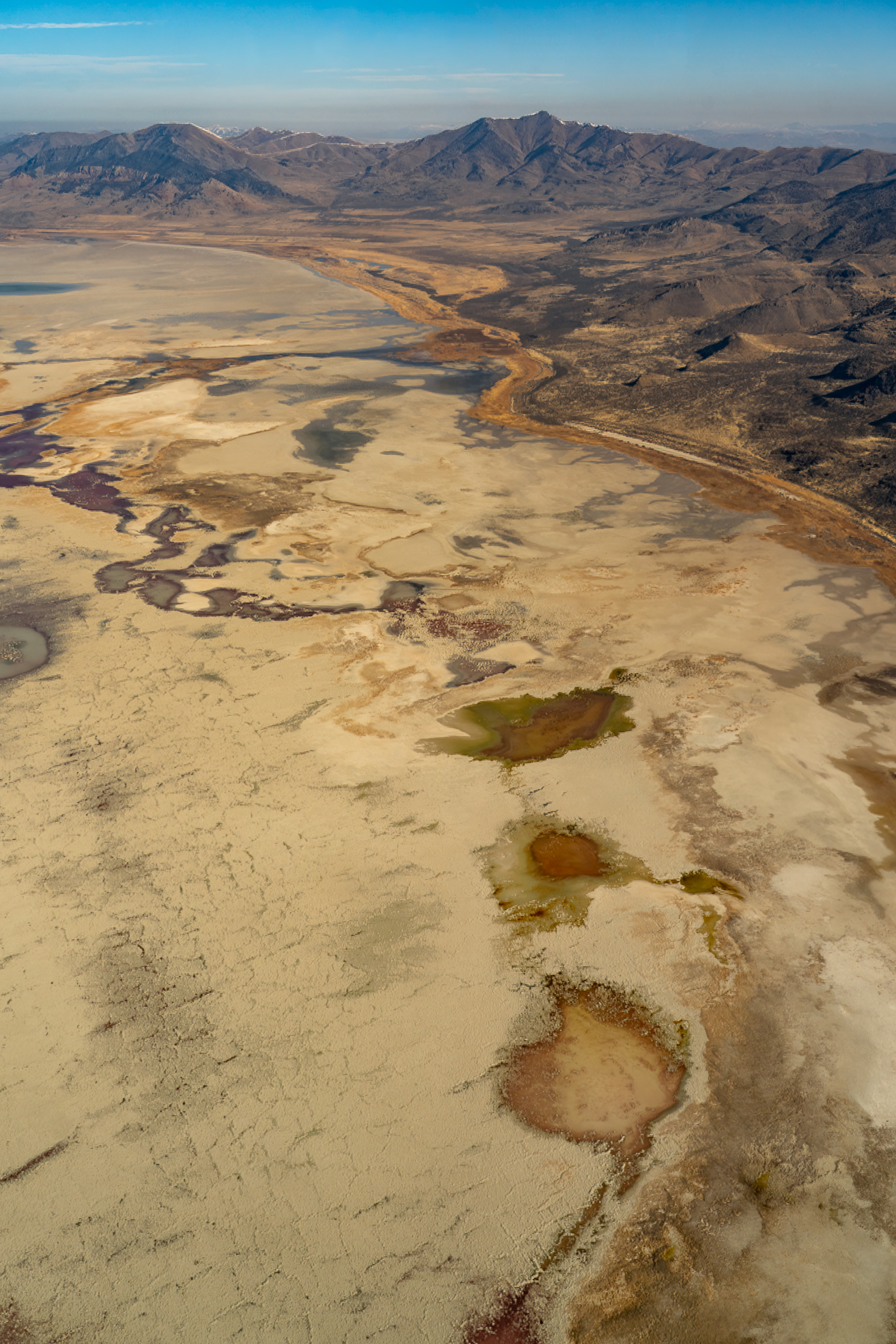
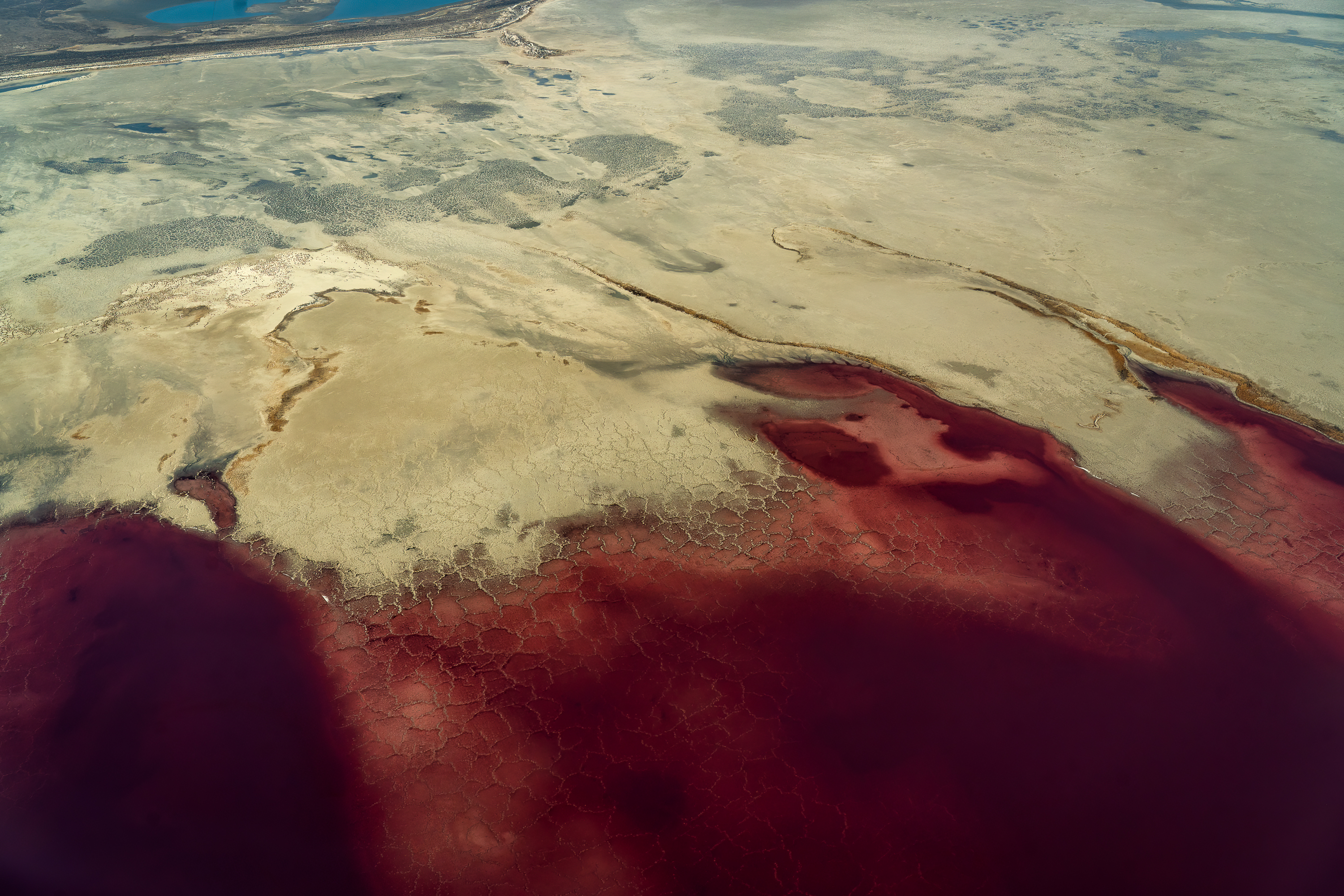
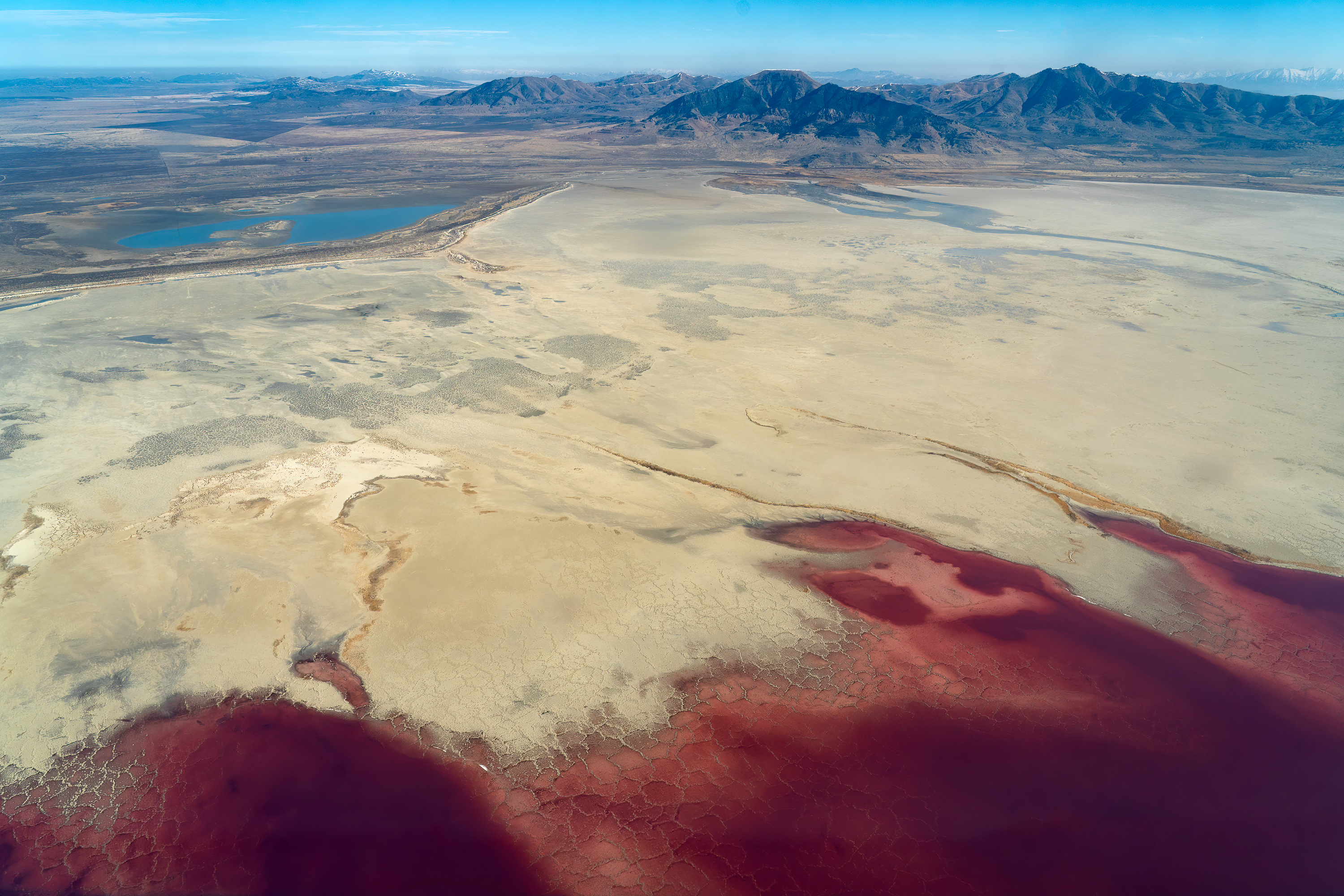
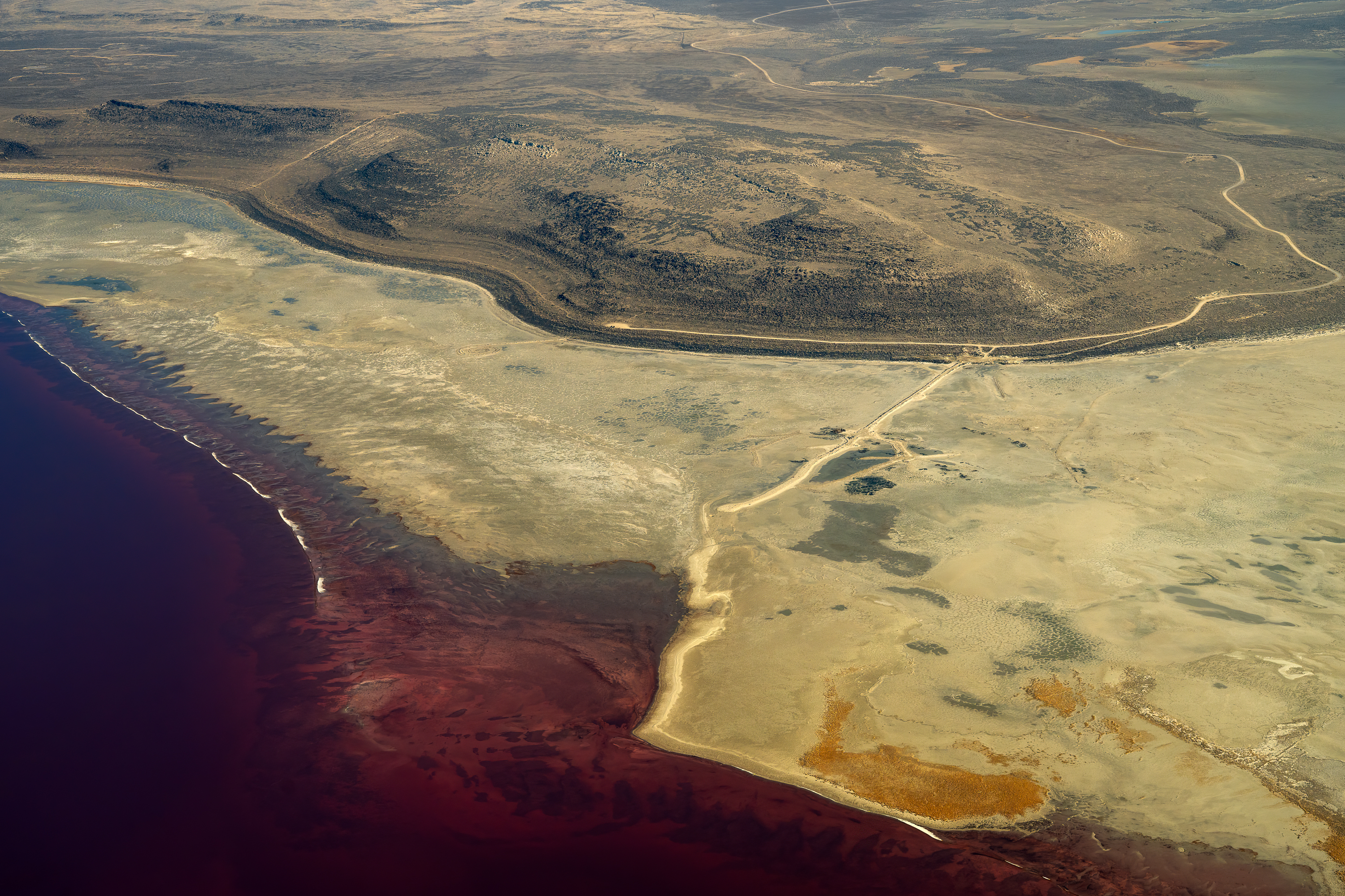
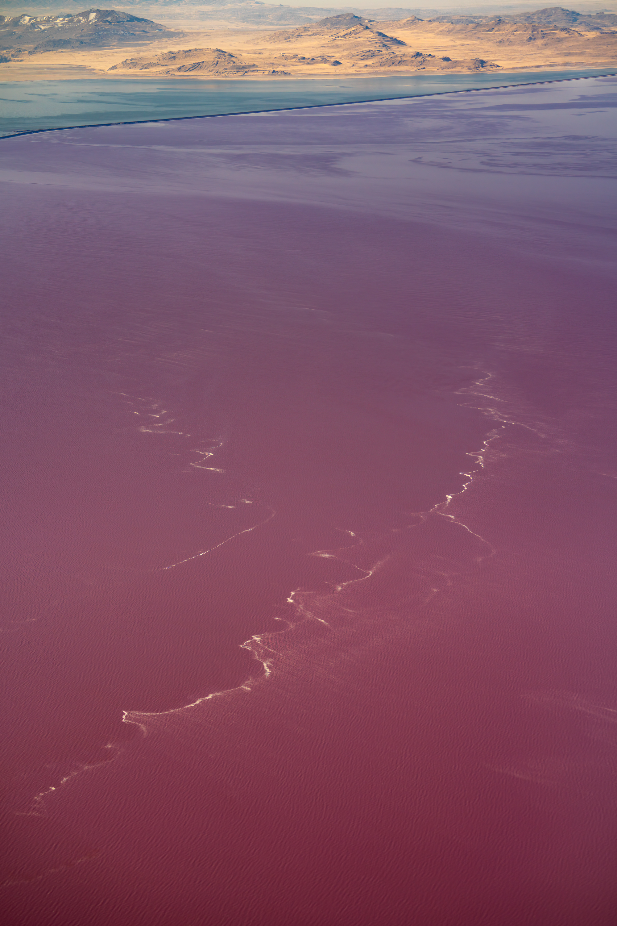
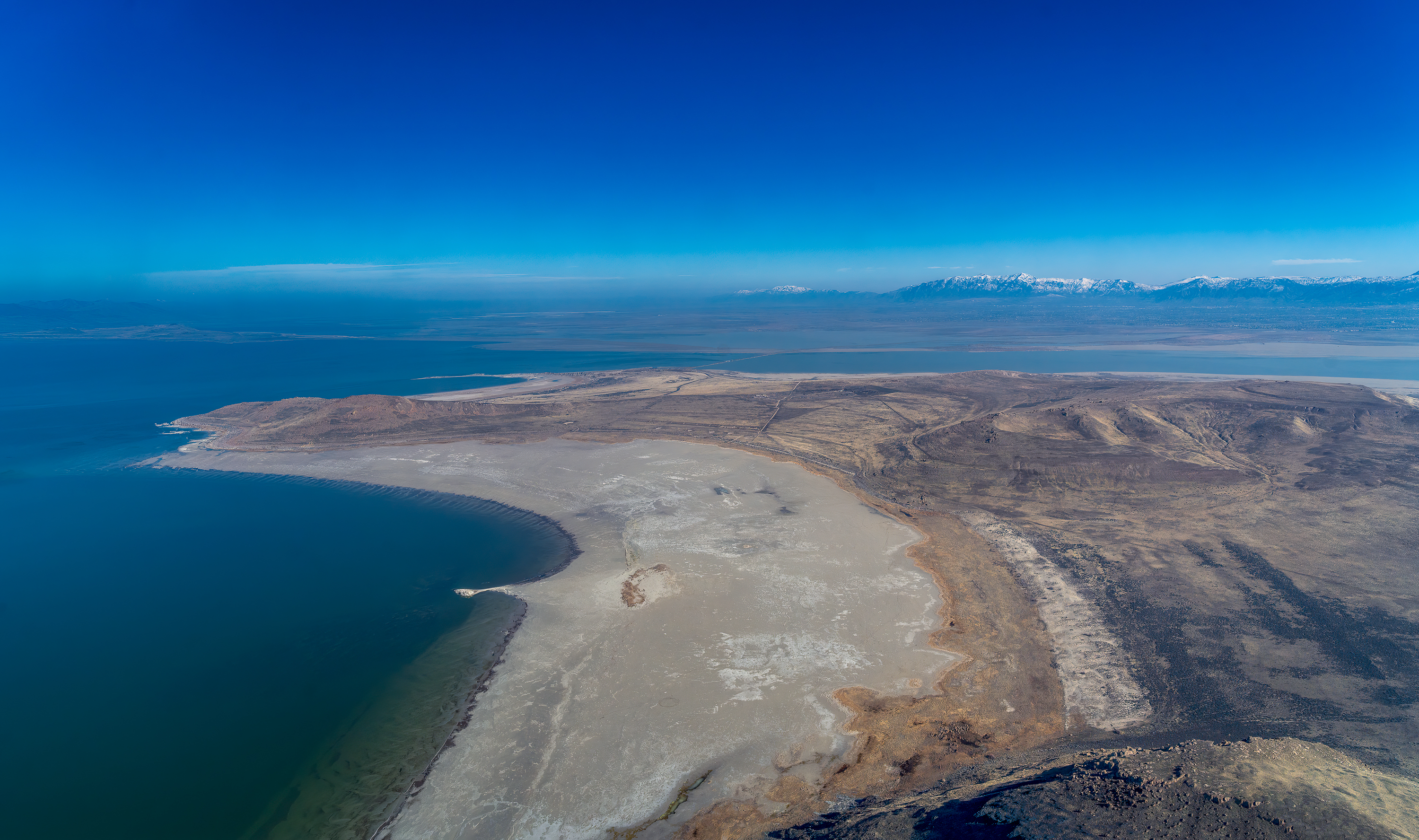
We were so close to the crest of Promontory Mountains I could see individual juniper bushes below (photo #6). I’ve often wanted to explore this long range that protrudes into the GSL, but unfortunately access to it is legally difficult as it is surrounded by barbed wire and private ranches. Quickly we passed over and into the large North Arm basin of the GSL where we could immediately see the effects of the multi-decade drought that we are in the midst of (photos #7, 8 & 9). The reddish-purple hue of the North Arm of GSL is due to halophilic bacteria, which loves hyper-saline environments. Photo 10 shows the art landform of the Spiral Jetty, designed and created in 1970 by Robert Smithson. In the 1980’s in was submerged under the rising waters of the lake, but those days are long gone and it’s about a ½ mile walk from the Jetty to the water’s edge. Also seen in this image is the long straight Rozel Point jetty. The jetty, and some pilings, are what’s left of the Rozel oil field that produced about 10,000 barrels of oil between 1904 and the early 1980’s. The oil was difficult to extract, difficult to refine and the wells were threatened by the then rising waters of the lake. There are still crude black tar seeps there but the wells have been capped and after years of rusty equipment sitting around, the site was cleaned up in the early 2000’s.
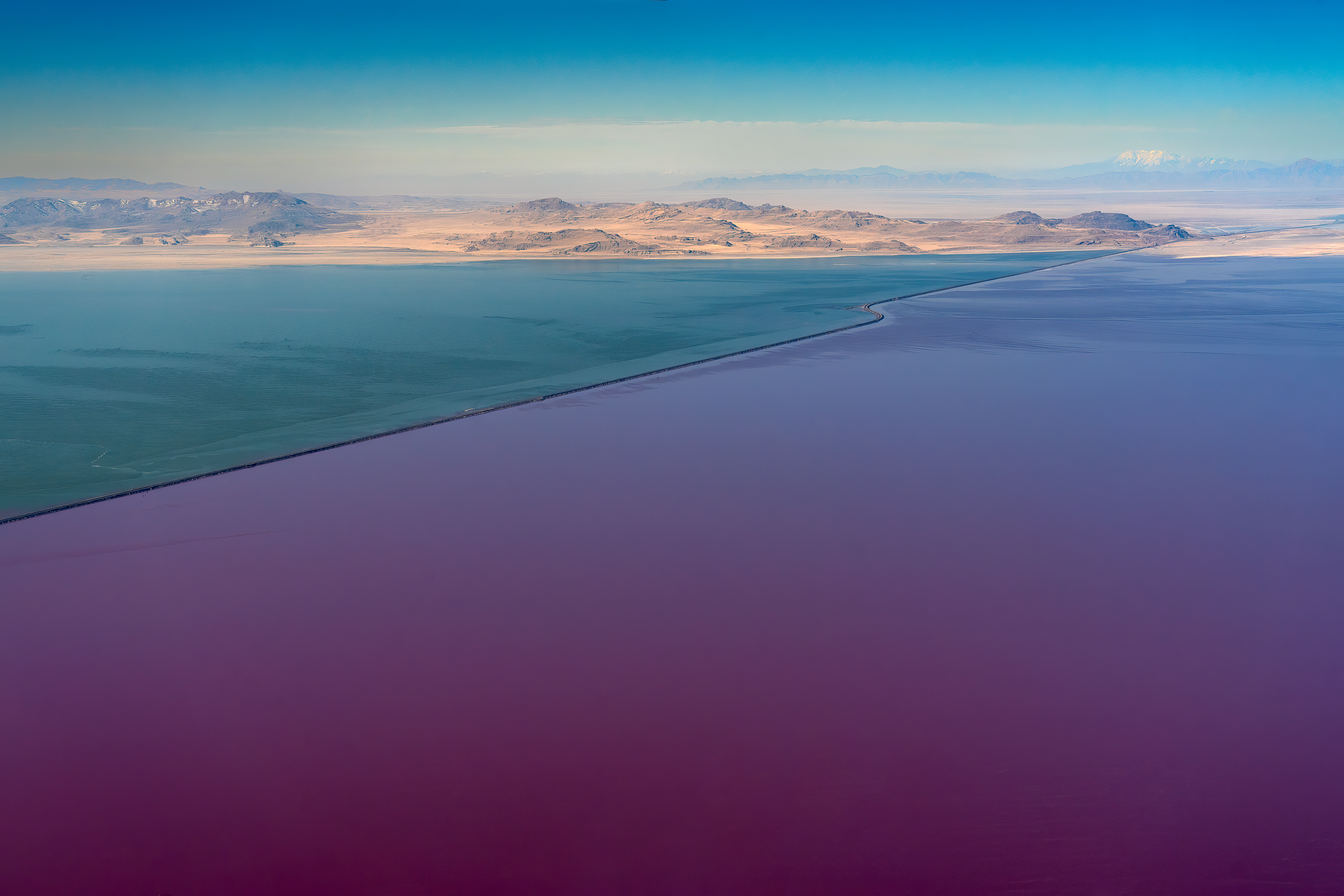
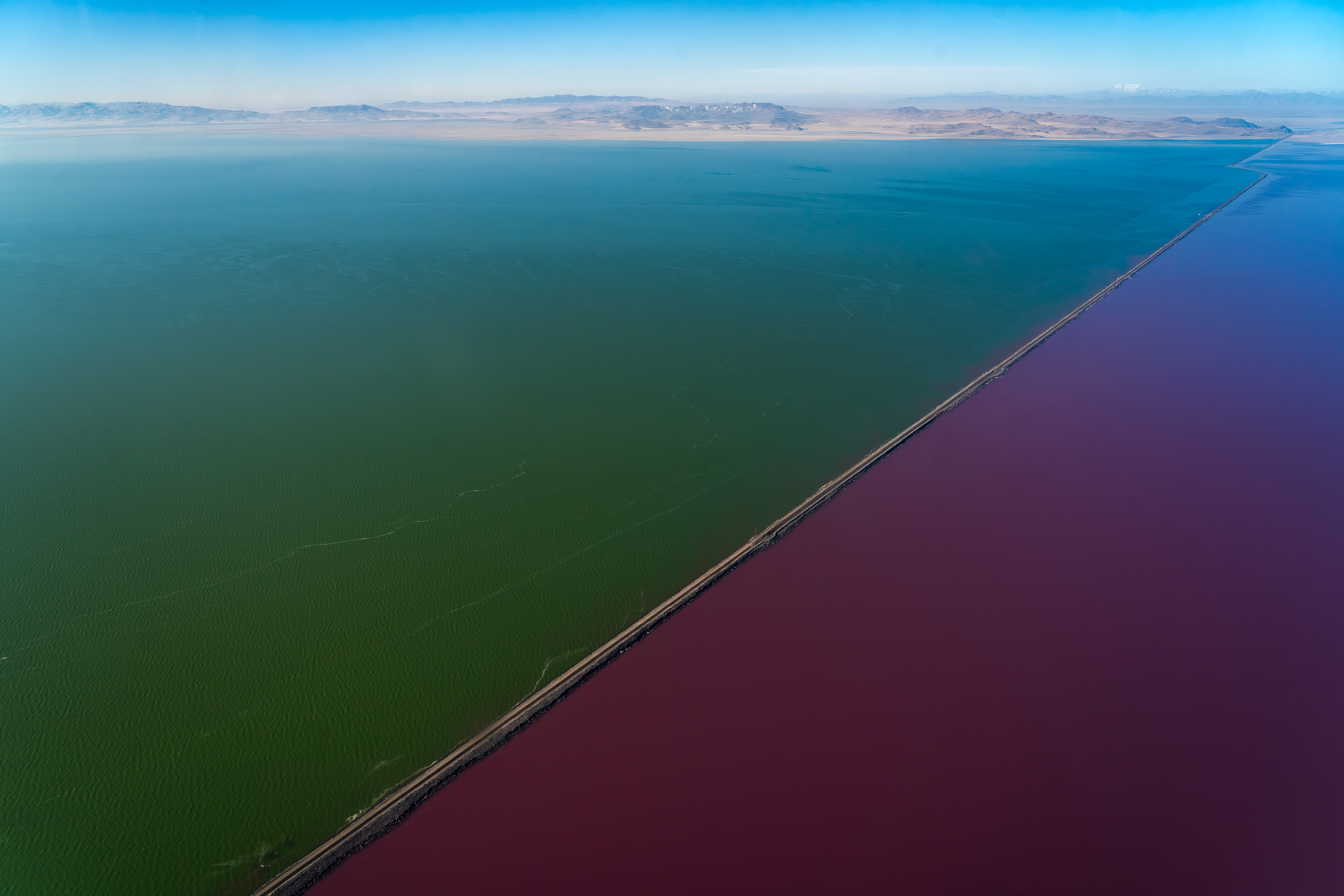
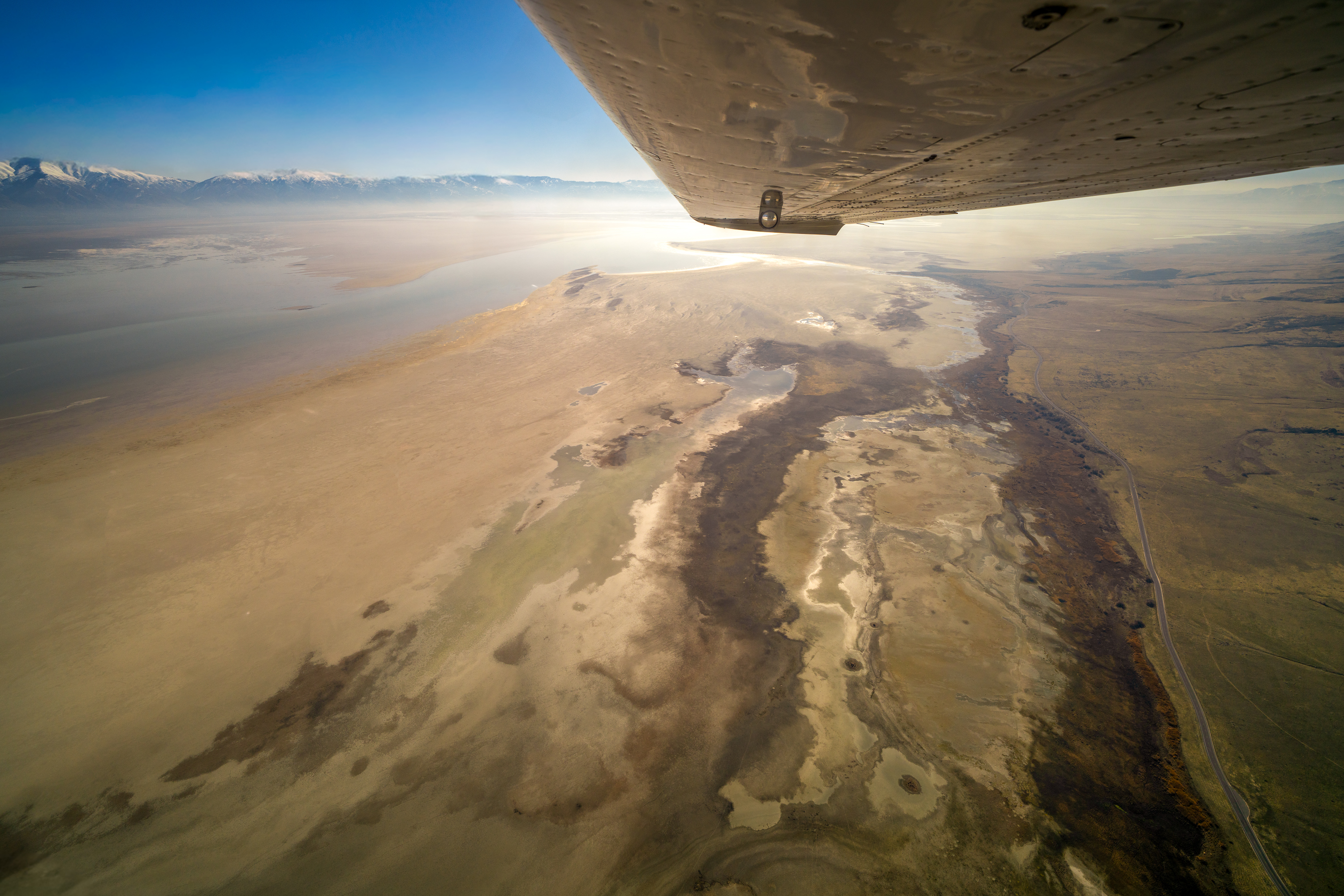
We then turned southeast and headed for Antelope Island, gaining expansive views of the red waters of Gunnison Bay with the Lakeside Mountains in the distance and the lake dividing line of the Union Pacific Railroad causeway (photos #11, 12 & 13). Built in the 1950’s the causeway is about 20 miles long and 15 or so trains cross it every day. (I have camped at Spiral Jetty a number of times and though I cannot see the trains from there, I can hear their mournful horns from miles away at night.). It replaced the Lucin Cutoff which was a long wooden bridge that did not restrict water from between the north and south arms. Since building the causeway the North Arm has increased in salinity, and it wasn’t until 2016 that a bridge was built on the causeway permitting – in theory – water to flow between Gunnison Bay in the north and Gilbert Bay in the south. Currently the salinity levels on both sides of the causeway are a yearly concern, compounded by rainfall, the winter snowpack, hot summers, and increasing water diversions upstream.
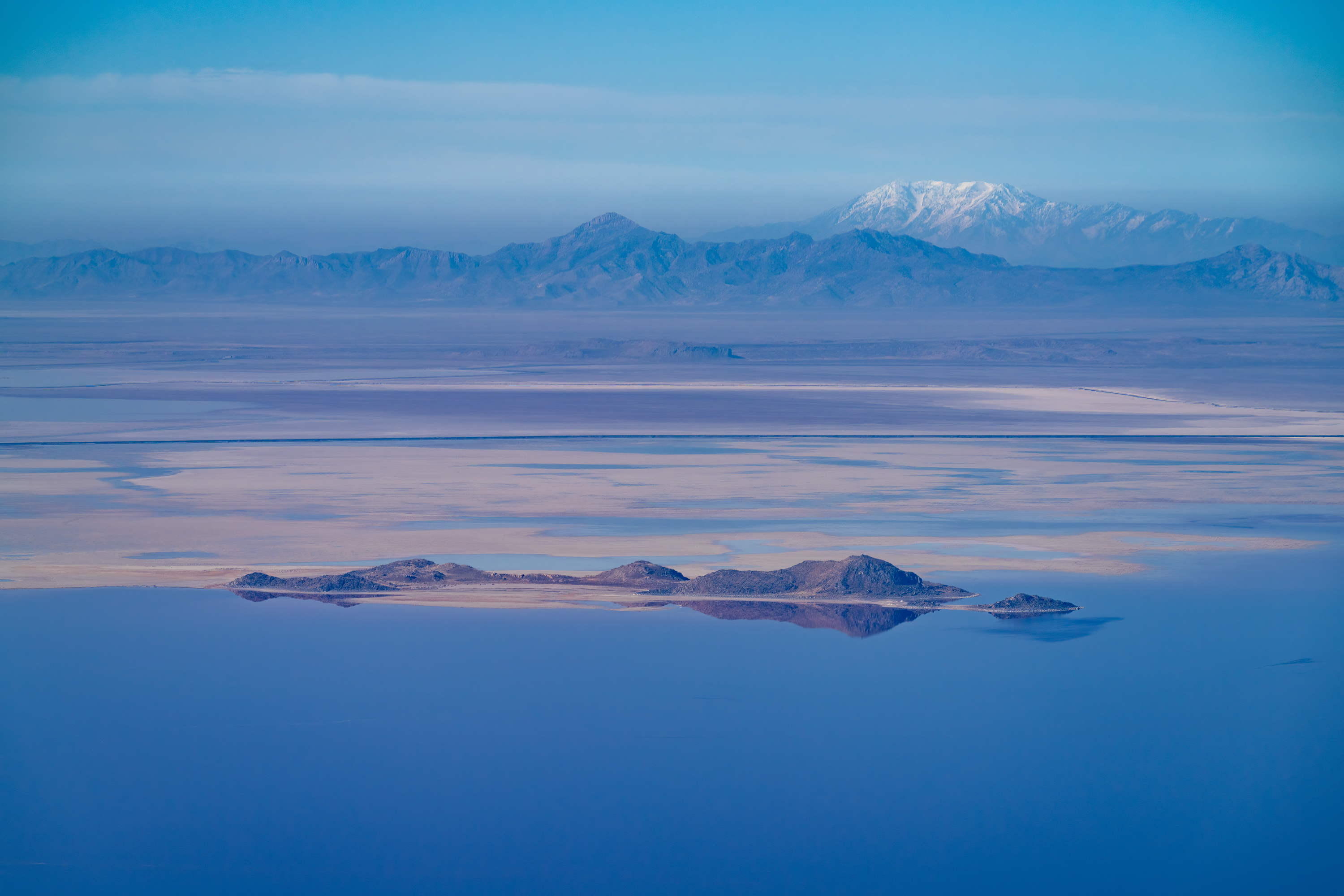
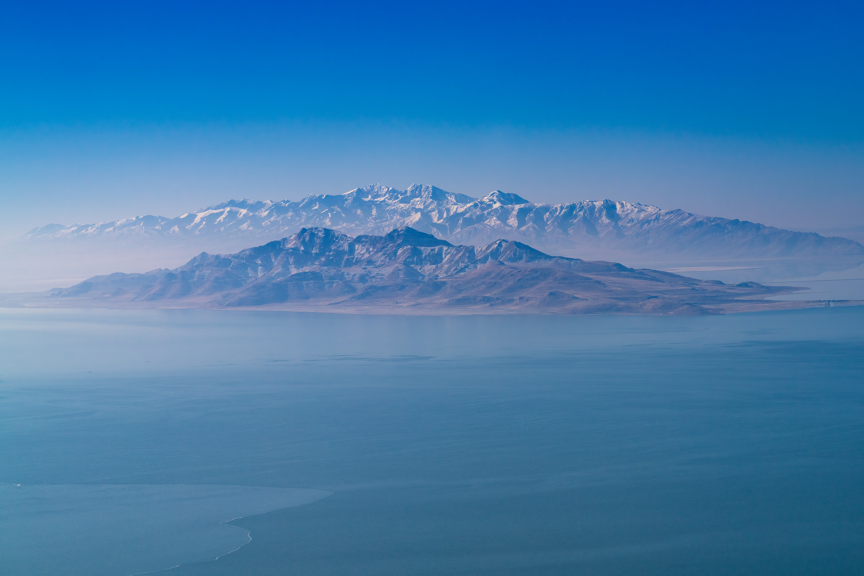
In the distance, and with a telephoto lens, I was able to photograph Gunnison Island and the smaller Cub Island (photo #14), neither of which appear to still be islands. These are major rookeries for the American White Pelican but are threatened by the lake level dropping which permits land predators access to the islands. Further to the south is the second largest island in the lake: Stansbury (photo #15). Looming behind it is snowy Stansbury Mountains. Both are named after the surveyor Howard Stansbury who documented much of this region in an expedition here in 1849-1851.
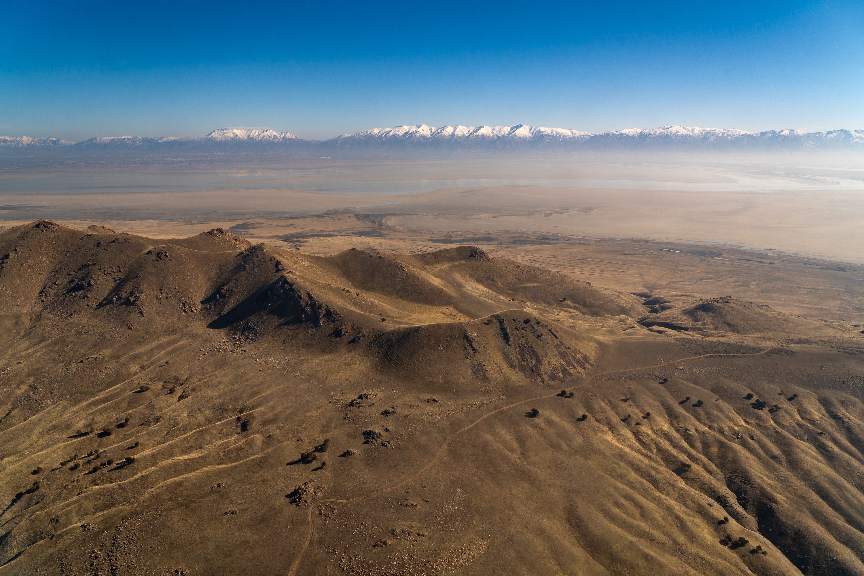
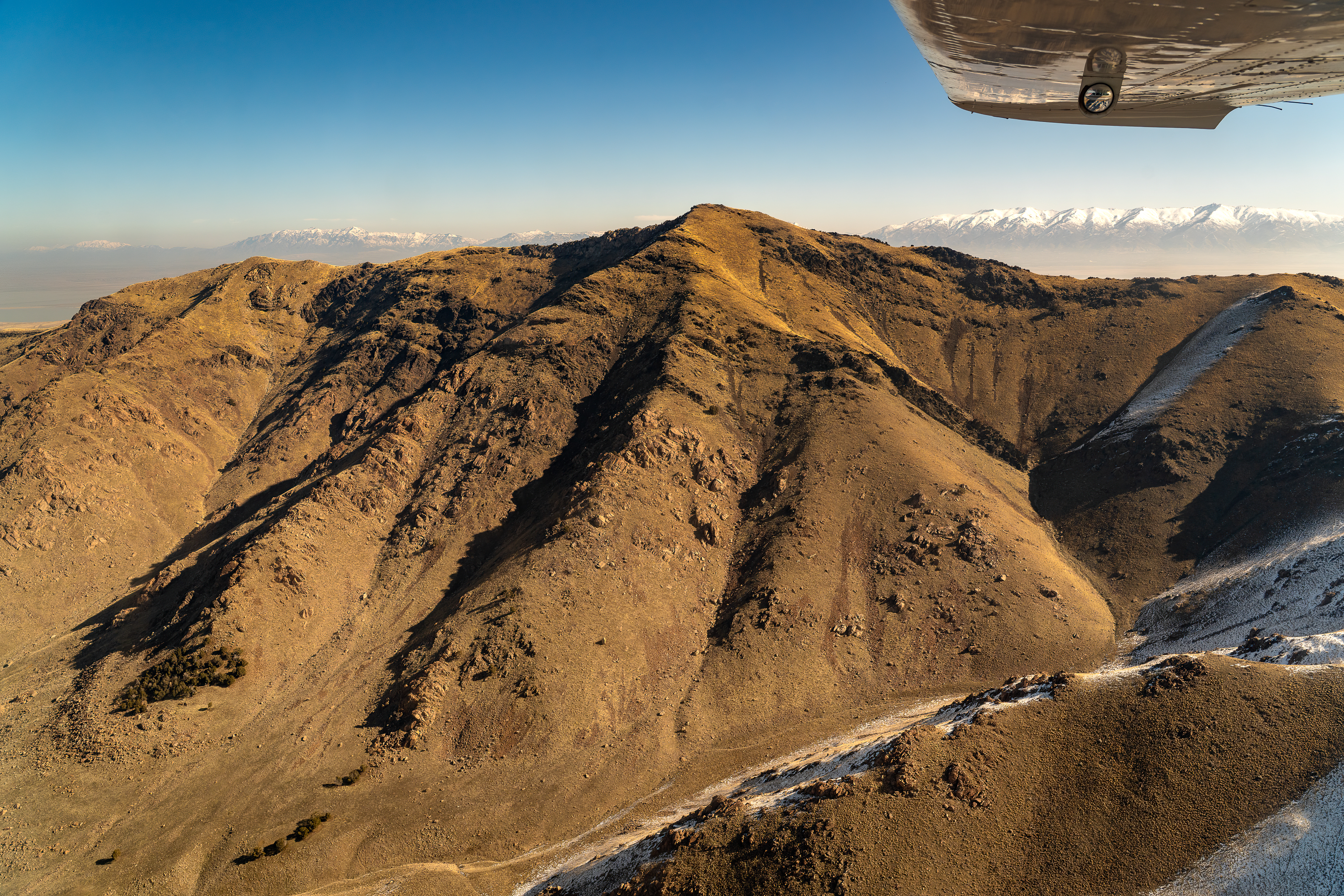
Finally, we reached our goal: Antelope Island. We flew down the west side of the long island and it wasn’t until we banked over the southern end that I was able to start taking photographs. My first shot (photo #16) shows the hills of the Sentry loop trail area and Fielding Garr Ranch beyond it. Of course, the Wasatch Range is in the background. (Fielding Garr was continuously inhabited by ranchers from 1848 to 1881. If you have not, it is a wonderful place to visit and photograph and you might even be lucky enough to see the owls there.) We flew north just to the west of Frary Peak, named after 19th century homesteader George Frary and the high point of the island, seen in image # 17. Then we were treated to a wonderful panorama of the northern area of the island including a very dry White Rock Bay (photo #18). Becky wanted a second go at photographing the crest of the island, so we circled around to cross perpendicular to the crest line and just to the north of Frary Peak. Images #19 and 20 were certainly the most difficult to take and process as I was shooting through thick plexiglass and into the sun. Focus was a challenge and the reflections were atrocious. Passing over to the east side of the island the drying of Farmington Bay was stunningly depressing (photo #21). Everything was anticlimactic after that as we winged our way over Layton’s suburbs (photo #22) and back to a safe and uneventful landing at Ogden Airport (photo #23).
This GSL overflight was a unique and special event for me as a photographer and as an individual concerned with the on-going plight of our Great Salt Lake. I was honored and fortunate to be asked to shed my cousin “Crazy” Jimmy small aircraft fears and climb aboard for this flight. Glad I did and would gladly do it again!
* The geology of Antelope Island is indeed fascinating … I least to an armchair geologist who once had serious but youthful aspirations to be a geophysics professor! Suffice it to say that the island has some of the oldest rocks on earth — 3.5 billion years old — to some of the youngest, depositions from 1.6 million years ago. Many of these rocks are readily observable from the ground in cliff bands, canyon walls, outcroppings, and large boulders. Also easily seen are the ancient lake shorelines, cut and deposited tens of thousands of years ago. Finally, the island presents a smorgasbord of all three rock types: igneous, sedimentary, and metamorphic which in turn makes the geology all that more complex and … fascinating!